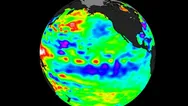
El Niño is officially over, federal forecasters announced Thursday, but we’re not quite in a La Niña yet. We’re in the middling “ENSO-neutral” phase.
What had been a potent “super” El Niño is now officially over, federal forecasters announced Thursday. They also said the hurricane-boosting La Niña climate pattern is expected to begin over the next few months.
“The team still favors La Niña to emerge sometime during the summer months,” the forecast from the Climate Prediction Center said, putting the odds at 65%. Looking beyond that, La Niña also has an 85% chance of persisting through the winter of 2024-25, forecasters said.
La Niña often creates weather patterns that increase hurricane activity in the Atlantic Basin, which includes storms that form in the Caribbean Sea and Gulf of Mexico. It also affects winter weather in the U.S. and around the world.
In contrast, the outgoing El Niño pattern usually helps suppress Atlantic hurricane activity, experts say. (It can have many other effects too, including boosting global heat.)
Can La Niña worsen the Atlantic hurricane season?
According to the Climate Prediction Center, La Niña can contribute to an increase in Atlantic hurricane activity by weakening the wind shear over the Caribbean Sea and tropical Atlantic basin, which allows storms to develop and intensify.
It’s one of the reasons forecasters have predicted a “hyperactive” hurricane season in the Atlantic Basin this year; one forecast predicted as many as 33 named storms. An average year sees 14.

Not quite La Niña yet
Forecasters also said Thursday that the planet is not quite in a La Niña yet: As of June, we’re in the middling “ENSO-neutral” phase, a halfway point between the two influential climate patterns.
“ENSO-neutral conditions returned during the past month,” the Climate Prediction Center said in its monthly update. This means seawater temperatures in the Pacific Ocean are neither unusually warm nor unusually cool.
What is El Niño? What is ENSO-Neutral?
El Niño is a natural climate pattern in which sea surface temperatures in the central and eastern tropical Pacific Ocean are warmer than average. It occurs, on average, every two to seven years.
Its name means “the little boy,” or “Christ child” in Spanish. El Niño originally was recognized by fishermen off the coast of South America in the 1600s with the appearance of unusually warm water in the Pacific Ocean around Christmas.
The entire natural climate cycle is officially known as El Niño – Southern Oscillation, called ENSO by scientists. The cycle swings between warmer and cooler seawater in a region along the equator in the tropical Pacific. La Niña is marked by cooler-than-average ocean water in the region.
When water temperatures are neither unusually warm nor cool, “ENSO-neutral” conditions are declared.
What will La Niña bring next winter?
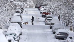
A typical La Niña winter in the U.S. brings cold and snow to the Northwest and unusually dry conditions to most of the Southern states, according to the Climate Prediction Center. The Southeast and mid-Atlantic also tend to see higher-than-average temperatures during a La Niña winter.
Get the Daily Briefing newsletter in your inbox.
The day’s top stories, from sports to movies to politics to world events.
Delivery: DailyYour Email
New England and the Upper Midwest into New York tend to see lower-than-average temperatures, the Weather Channel said.
Outgoing El Niño was one of the strongest in recorded history
The most recent El Niño will go down as one of the five strongest in history, the World Meteorological Organization said. Coupled with climate change, it helped boost global temperatures to the highest on record in 2023.
But “the end of El Niño does not mean a pause in long-term climate change as our planet will continue to warm due to heat-trapping greenhouse gases,” World Meteorological Organization deputy secretary-General Ko Barrett said this month.
Author:: Bagombeka Job
CREDIT:: USA TODAY


